
Projects
Survey, Mapping and Geomatics

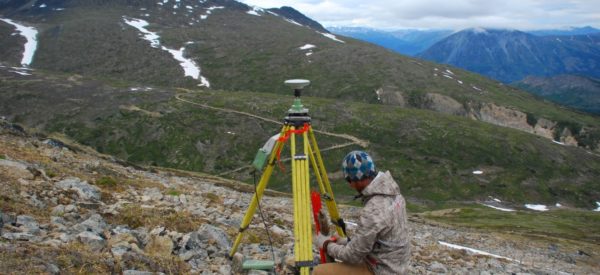
White River First Nation Legal Surveys
Project Summary Challenger worked with White River First Nation, Yukon Government and Indigenous Services Canada to survey several parcels identified as Lands Set Aside for the use of the White River First Nation. Project Duration: Throughout 2022-2025 Project Manager: Mason Gray Approximate Hours: 800 hours Service Delivered and Outcomes Products Provided: Legal Survey Plans registered […]

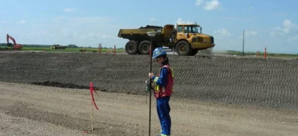
Arbour Lake Housing Project
Project Summary Challenger was contracted by Screwco to deliver surveying support for the installation of screw piles and associated pile caps for pre-built modular homes under ATCO’s Affordable Housing program across the province of Alberta. Project Duration: Two weeks Project Manager: Drew Stodalka Approximate Hours: 150 field and office hours Service Delivered and Outcomes Products Provided: […]

Hudson Bay Bathymetric Survey
Project Summary Kitikmeot Challenger completed a high-resolution bathymetric survey in northern Hudson Bay. The work was requested and funded by Fisheries and Oceans Canada (DFO) and the Canadian Hydrographic Service (CHS) under the Government of Canada’s Oceans Protection Plan. The survey captured detailed multibeam data to support safer navigation, scientific research, and improved understanding of […]

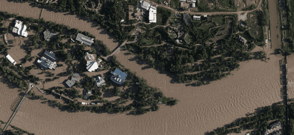
Calgary Flood Mapping
Project Summary In response to the 2013 Calgary flood, our team provided critical pre- and post-flood mapping on the second day of the disaster, aiding emergency response efforts and supporting flood insurance assessments. Our data helped residents navigate recovery efforts and was utilized by the City of Calgary on their website to share real-time updates […]
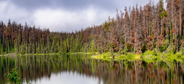
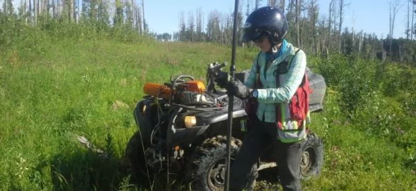
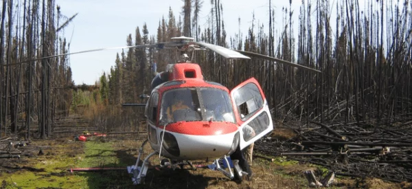
Mountain Pine Beetle (MPB) Aerial Survey
Project Summary In 2010 and 2012, our team successfully completed a large-scale project aimed at identifying and mitigating the spread of the destructive pine beetle in County of Grande Prairie, M.D of Greenview, M.D of Big Lakes and Wood Buffalo). Utilizing advanced photogrammetry techniques, we conducted aerial surveys, capturing remote data immediately after each flight. […]
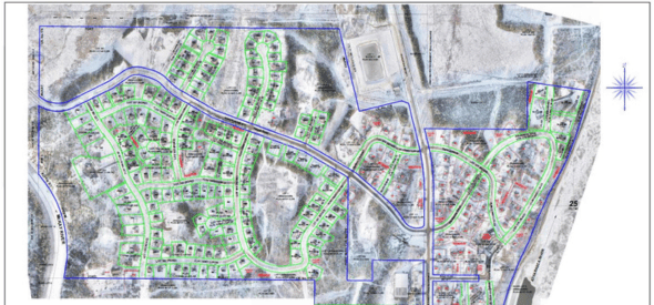
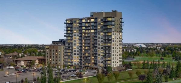
Park and Maven Multi-Phase Development
Project Summary We proudly supported the Park & Maven – Urban Homes development from its early planning stages in 2019 through to present day. This multi-phase development consisting of townhomes and condo buildings containing 11 Townhouse buildings – 57 units + 7 condo buildings – 550+ units. Our work has been extensive and integral throughout […]
Wren and Raven Commercial and Residential
Project Summary The project was a commercial and residential combo construction project. Consisting of 2 main, 5 Storey, residential condo buildings with the first level being commercial units and another 7 commercial buildings on the property. The Initial site was 34 acres and subsequent construction lot was 12 acres. We were involved with project since […]
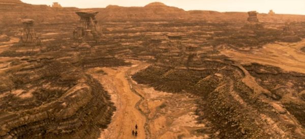
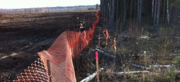
Gwich’in Land Claims Aerial Survey
Over the course of four photo acquisition dates, Challenger successfully captured 1,795 aerial photographs at a ground sampling distance (GSD) of 25 cm across the Gwich’in Land Claims Settlement Areas, covering a vast area of 55,000 square kilometers in the Northwest Territories for Natural Resources Canada (NRCan). Key aspects of the project included: Imagery Acquisition: […]
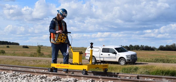
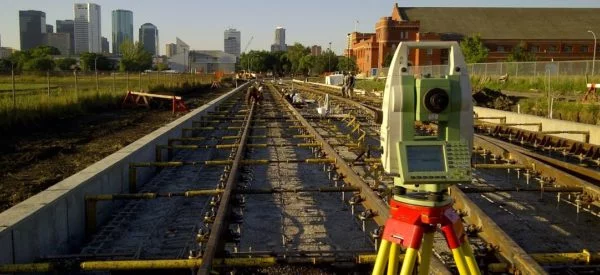
Jansen Rail Connector
Project Summary The Jansen Rail Connector project involves constructing a 22-kilometer rail connection between CN Rail and the BHP Jansen Potash mine site in Jansen, Saskatchewan. This crucial infrastructure link will support the efficient transportation of potash, a key agricultural commodity. Rail Connection: 22Km Rail Connection to the BHP Jansen Potash mine site for CN […]
First Nation Land Management
Project Summary Legal survey for Fort McKay First Nation of existing Internal Community roads to finalize the internal survey fabric within their Reserve lands. One of many stages supporting the Band’s development of a Land Code for their Community under the Framework Agreement on First Nation Land Management (FNLM). Services Delivered UAV survey and custom […]
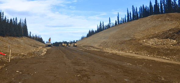
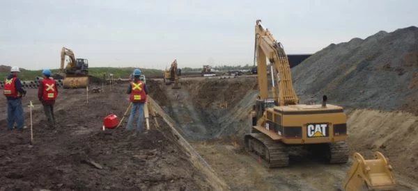
Carmacks Bypass
Project Summary Construction of a 2 lane 5km Bypass Road from the North Klondike Highway to the Mount Nansen Road near Camacks. Included in this work was the construction of a bridge over the Nordensgold River. Services Delivered Construction Layout, As-built Surveys, Progress Quantities CAD Drawings to support Unit Rate Claim Amounts
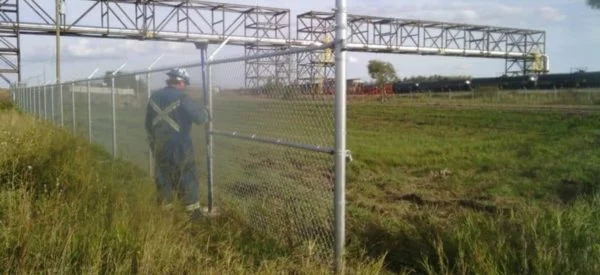
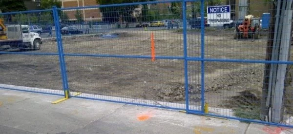
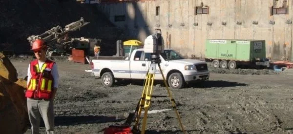
Refinery Concrete Repairs
Project Summary Imperial Oil was performing concrete repairs at Terminal 88 within the Edmonton Refinery. Due normal wear, portions of the concrete pad at this location were starting to show signs of deterioration. Imperial Oil planned to cut out and repair sections of concrete that were in poor condition. Prior to cutting out concrete, underground […]
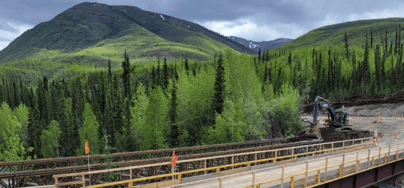
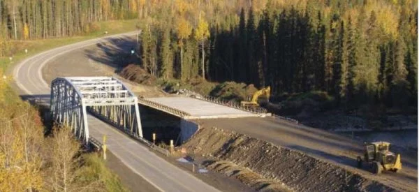
Lapie River Bridge Support
Project Summary Construction of a new bridge and road realignment over the Lapie River on the South Canol Road. Challenger was responsible for Construction Layout of a new bridge over the Lapie River, highway realignment and volumetrics. Services Delivered Construction layout of a new bridge Highway realignment Volumetrics
City of Calgary Digital Aerial Surveys
Project Summary Challenger has been the Digital Aerial Surveys (DAS) contractor for the City of Calgary since 2005. DAS project includes the City of Calgary yearly based air photo acquisition (6.5cm ~7.5cm GSD) , ortho mosaicking and digital mapping updates for the whole City (section based; 453 sections total). Services Delivered Extra-Large Format Digital Camera […]
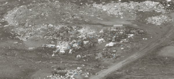
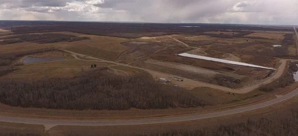
Solid Waste Management Feasibility Study
Project Summary A Solid Waste Management Feasibility Study was completed for 13 communities across Nunavut. Sub-Arctic Geomatics was tasked with creating 3D models of the landfills, calculating volumes, and gathering other topographic information for the future design phase. Services Delivered Drone/ UAV centimeter resolution models, allowing in depth research miles away from site. 3D images […]
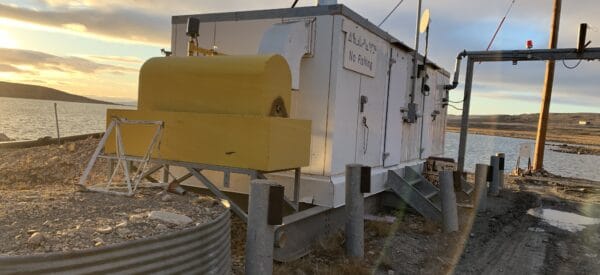
Water Treatment and Reservoir Surveys
Project Summary Sub-Arctic Geomatics created 3D models of various Nunavut hamlet water reservoirs and survey water treatment parcels of land. This allowed an accurate calculation of water volumes – critical to the hamlet. As well as vital information for future design phases and upgrades to water treatment plants. Services Delivered A single beam sonar was […]
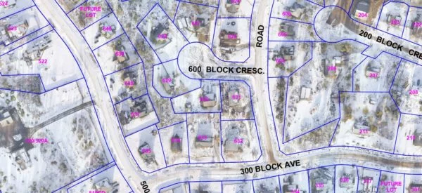
Canadian Arctic Legal Surveys
Project Summary Sub-Arctic Geomatics completed numerous legal surveys throughout Nunavut, Canada. Below are photos depicting the subdivision our team did of Lot 795 separating it into four lots. This was done to allocate specific lots to the existing legal non-conforming improvements (Lots 2 and 3) and create vacant lots suitable for potential future development in […]
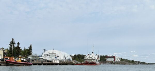
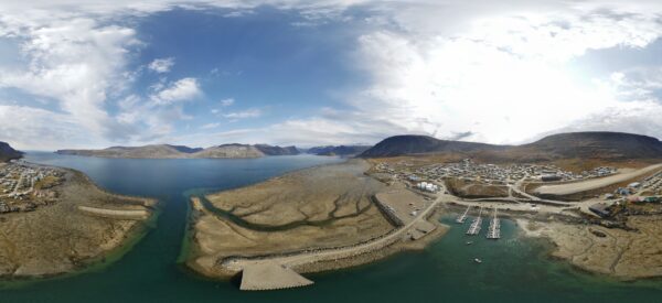
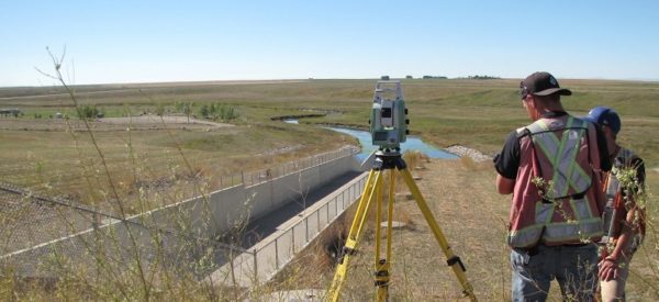
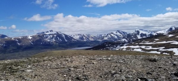
Great Slave Lake – Bathymetric and Topographic Survey
Project Summary Det’on Cho Challenger Geomatics was asked by Department of Fisheries and Oceans Canada to complete a bathymetric and topographic survey of their compound on Great Slave Lake in Yellowknife. Services Delivered A single beam sonar was used to complete a 2m grid of the area surrounding the wharf. A plan showing all fences, […]
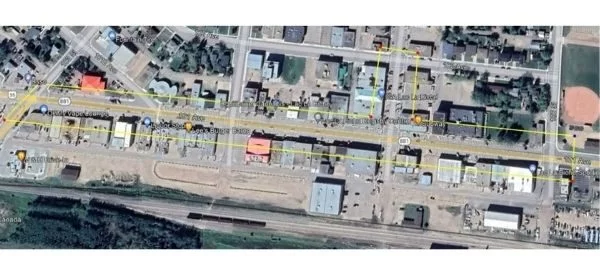
Lac La Biche – Downtown Site Survey
To support planning and engineering design, Challenger provided a topographic site survey of the downtown of Lac La Biche.
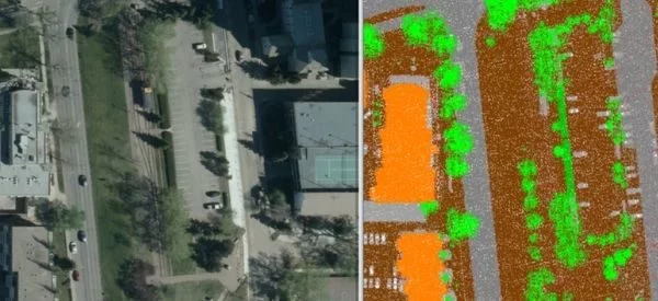
Canopy Cover Analysis
This project involves the use of existing City of Edmonton remote sensing and landscape feature datasets to analyze the canopy cover of Edmonton’s urban forest.
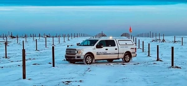
Old Crow Solar Array
Challenger provided survey support for the development of a new solar array in Old Crow, Yukon. The project is anticipated to displace 190,000 litres of diesel fuel every year.
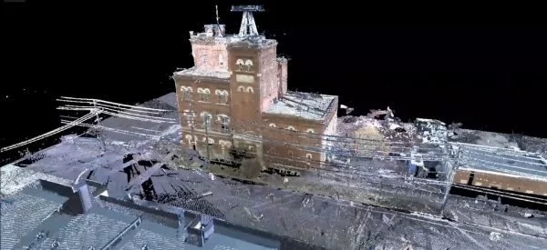
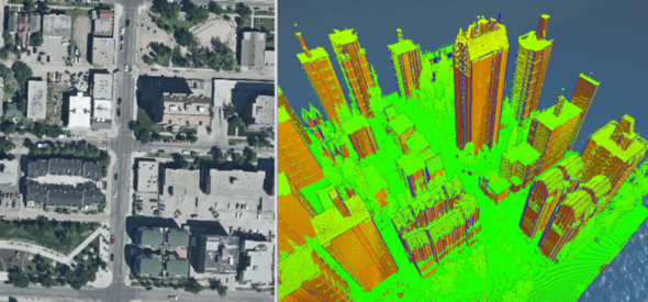
Molson Brewery Scan
Anchoring the Edmonton Brewery District is the century-old Molson Brewery. To support project planning and design, Challenger completed a full scan of the building interior and exterior.
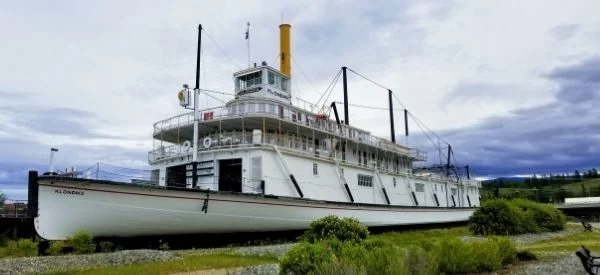
Laser Scanning – S.S. Klondike
The second of two sternwheelers bearing the name, the S.S. Klondike carried freight between Whitehorse and Dawson City along the Yukon River from 1937 to the early 1950’s. In 1967, it was designated a National Historic Site of Canada and moved to its current location along the banks of the Yukon River. Challenger scanned the vessel interior and exterior to support Parks Canada’s ongoing preservation and restoration work.
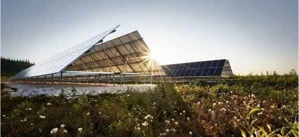
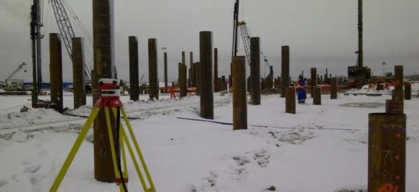
Travers Solar Farm
Covering 3300 acres of land and eventually producing 465 MW of electricity, the Travers Solar Project is the largest solar farm to date in Canada. Construction requires the precise layout of 228,000 piles.
Saddlebrook Solar Farm
The Saddlebrook Solar Project will consist of a solar generating facility along with a battery energy storage system.
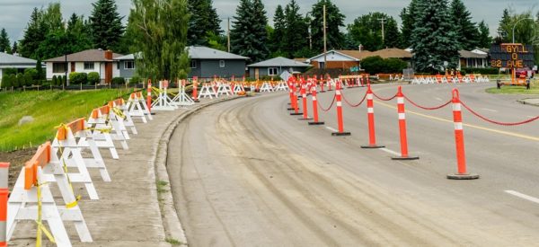
Local Road Plans – Brazeau County
Challenger provided road plans to Brazeau County to support the construction of various roads as well as services in support of the closure of an undeveloped government road allowance.
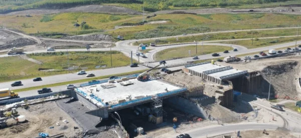
West Calgary Ring Road
The West Calgary Ring Road Project, running between Highway 8 and the Trans-Canada Highway, is the final phase of the Calgary Ring Road. Challenger provided construction survey services for grading, paving, and bridge construction.
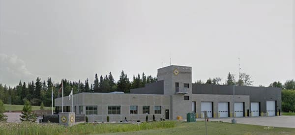
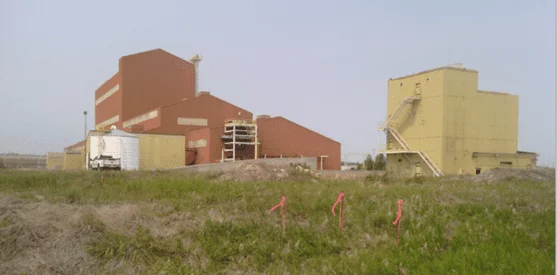
Acheson Fire Station Topographic Survey
Challenger has provided ongoing survey services for control monitoring of the building and surrounding area. Challenger also provided a detailed topographic survey of the site to support engineering design and measures to mitigate building and site movement.
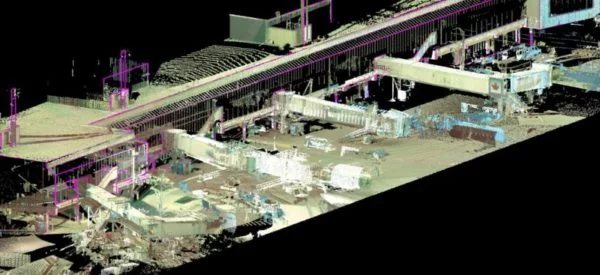
DIluent Recovery Unit (DRU) – Terminal Surveys
Challenger provided survey support for the design and construction of the new DRU site, rail terminal, pipe racks, and pipelines.
Base Line Terminal
Challenger provided mapping and construction survey support to our client in the development of new transportation infrastructure and storage capacity
Fort McKay Community Boundary Design
The Community of Fort McKay was mapped using our aerial drone. The imagery was then created and utilized to design 6km of road boundaries and 280 future lot boundaries.
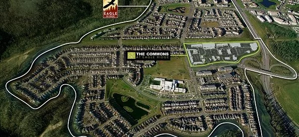
The Commons at Eagle Ridge
Challenger continues to provide construction and legal survey support for The Commons at Eagle Ridge, a large multi-phase commercial development in Fort McMurray. The shopping centre includes a gas bar, movie theatre, restaurants and other retail amenities.
3D Scanning – Lost in Space TV Series
Challenger worked with production crews to identify required mesh geometries needed to produce Lost in Space Season 2. We conducted full-resolution 3D laser scans of areas for location scout applications, art department pre-production and set planning.
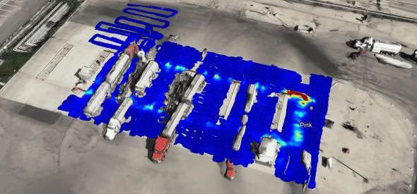
Landfill UAV Survey Program
Challenger surveyed numerous landfill disposal facilities across Western Canada using Unmanned Aerial Vehicles (UAV) to support our client’s volume calculations and annual reporting
Twin Valley Dam Deformation Monitoring
Challenger performed a deformation monitoring survey and displacement analysis on the Twin Valley Dam southeast of Calgary.
Drake17 Condominium Tower
Challenger supported the construction of the 17 story Drake Condominium Tower in the Connaught neighbourhood of downtown Calgary by providing control surveys and deformation monitoring during construction.
Shepherd’s Gardens Condominium Tower
The Shepherd’s Gardens Heritage condominium is a 15 story, 13-unit condominium tower in the Heritage / Century Park area offering independent living services and amenities.
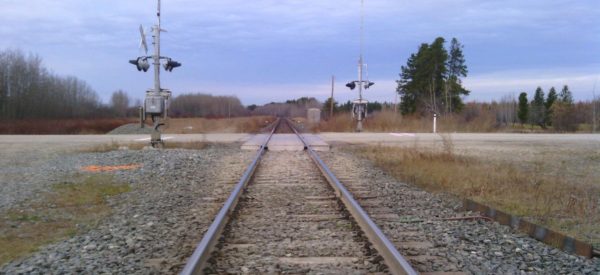
CN Edson Subdivision
Engineering survey from Mile 80 to Mile 100 (32km in length) along the CN Edson Subdivision to allow for the development of an additional track along the south side of the existing mainline.
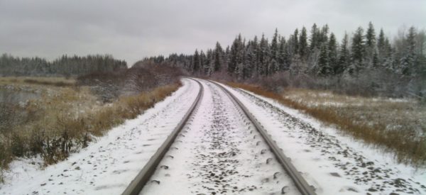
CN Vegreville Subdivision
Challenger provided construction survey services for the detailed design of grading and trackwork for 10 km of new track.
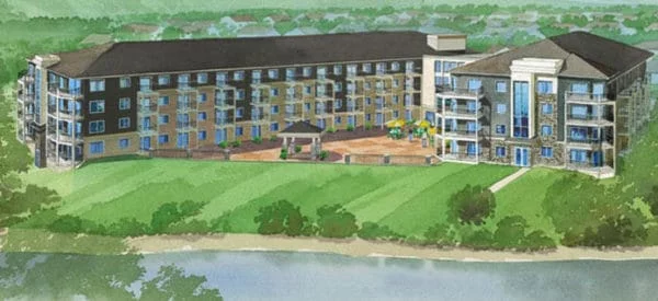
Hangingstone Landing Condominium Project
Situated on the Hangingstone River, Hangingstone Landing is a 139 unit residential development in Fort McMurray. The development included ground floor commercial space and a heated underground parking garage.
Enbridge Cheecham Terminal Expansion
Enbridge’s Cheecham Terminal, south of Fort McMurray, needed new tank, pump, and pipeline infrastructure to accommodate increased capacity associated with the Wood Buffalo Extension project. Challenger provided Enbridge with construction survey support.
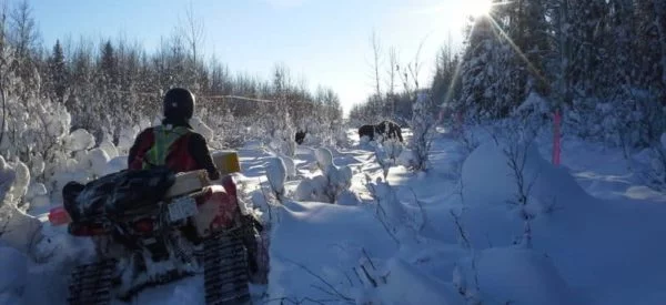
Faro Mine Remediation
Challenger has provided local geomatics support for the design of the remediation and the ongoing care and maintenance of this large-scale mine reclamation project.
Carmacks-Stewart Yukon Transmission Line
Challenger Geomatics provided a broad range of survey support for the construction of transmission and distribution lines between Carmacks and Stewart Crossing.
New Afton Mine
The New Afton copper-gold-silver mine is located approximately 10km from Kamloops in the central interior of BC. Challenger provided survey services in support of a spike in development activities to take the project to production.
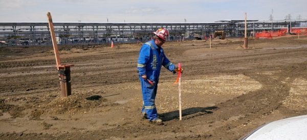
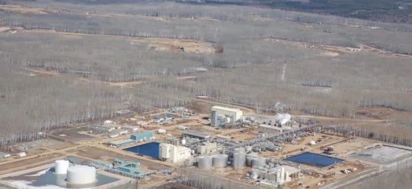
Northwest Redwater Sturgeon Refinery
The North West Redwater (NWR) Sturgeon Refinery is Alberta’s newest stand-alone refinery. The project is located about 45km northeast of Edmonton and is the first new refinery to be built in more than 30 years.
Bow Building Office Tower Development
Challenger provided survey services including topographic surveys, control surveys, deformation monitoring and layouts to support the construction of the Bow Building proposed by Encana in downtown Calgary.
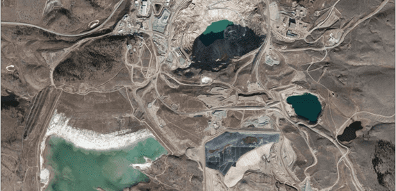
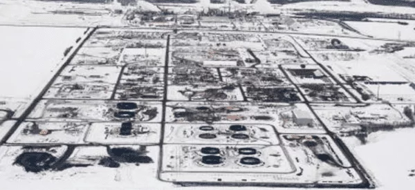
Kearl Oil Sands Project
Challenger provided survey and mapping services related to the new construction and later the expansion of an open pit mining operation located 70km north of Fort McMurray in the Athabasca oil sands region.
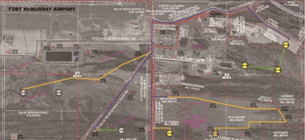
Edmonton Airport South Hangar
Challenger provided topographic surveys for the development, planning, quality assurance program, and quality control program for the South Hangar Development of the Edmonton International Airport.
City of Calgary Flood Aerial Survey
During and immediately after the 2013 Flood, Challenger provided digital aerial survey and mapping support for the City of Calgary. Included data collection for shoreline features along the Elbow River and Bow River water edges.
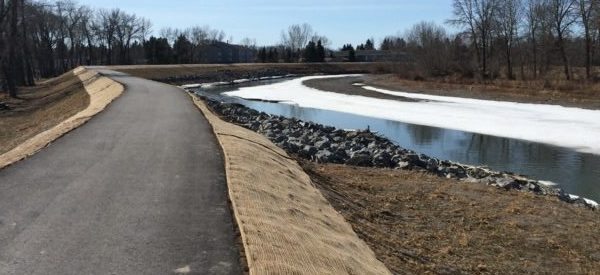
High River Flood Mitigation
After the 2013 flood, the town dike, west town dike, NW dikes, golf course dike, and Lineham Canal dike were all constructed to provide protection from future flooding.
Kaybob Duvernay Exploration
Challenger provided survey and mapping support for the exploration and appraisal of the Duvernay resource formation near Fox Creek, Alberta.
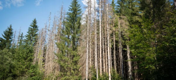
Alberta Mountain Pine Beetle Project
Challenger developed a new methodology for automatic identification of infested trees from airborne multi-spectral images and generated a GIS dataset that could be used by researchers.
Kudz Ze Kayah Mine
The Kudz Ze Kayah project is a zinc mine located in the northern Pelly Mountains, 115km south of Ross River in the Yukon. Copper, lead, gold, and silver are also present on the site.
North American Terminal Operations
Construction survey support for the construction of a new rail terminal in Bruderheim, Alberta.
Coffee Creek Mining
Challenger provided survey and mapping support for the exploration of this open pit and heap leach gold mine located approximately 130km south of Dawson.
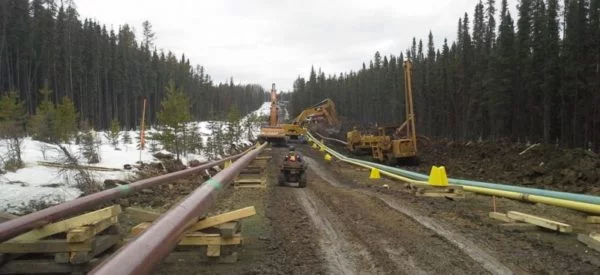
Keyera Wapiti Pipeline
Challenger provided survey support for the construction of Keyera’s 92km Wapiti multi-pipe right-of-way and various other pipeline projects in the Wapiti and Pipestone areas, near Grande Prairie.
Enbridge Bathymetric Survey
Challenger executes regular bathymetric and topographic surveys along the Mackenzie River crossing near Fort Simpson as well as Great Bear River crossing near Tulita to confirm pipeline integrity as part of Enbridge’s monitoring program.
Inuvik-Tuktoyaktuk Highway
Operating as one of our majority aboriginal-owned partnership companies, Inukshuk Geomatics Inc., Challenger provided survey support for km 52-138 of the Inuvik-Tuktoyaktuk Highway (ITH) project.
South East Stoney Trail
The Southeast Stoney Trail Project involved the construction of a six-lane 25km section of expressway from Peigan Trail to Highway 22X.
Southern MD’s of Alberta Aerial Survey Project
Challenger provided consulting services for Southern Alberta Aerial Survey Project. The project included digital aerial survey and mapping support for 41 hamlets, air photo acquisition, photogrammetry DEM data collection and maps.
Edmonton Metro Line LRT extension
North LRT expansion (Metro Line) including track replacement and reconfiguration for Churchill station and tunnel.
Northern Lights Oil Sands Exploration
Though the project ultimately did not go forward, Challenger provided survey and mapping support for the exploration and definition of new oil sands resources in the Northern Lights area.
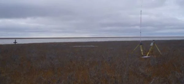
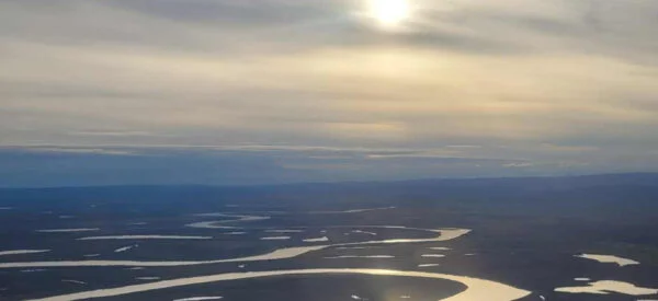
Mackenzie River Delta Bathymetric Survey
Bathymetric survey of the Mackenzie River Delta at a proposed offshore well site to be drilled atop an ice-pad.
MacKay River SAGD Development
Challenger provided survey and mapping support for the exploration and definition of oil sands resources and also for the staged development of the steam assisted gravity drainage (SAGD) facility and associated infrastructure.
Lewis and Meadow Creek Oil Sands Exploration
Lewis is a proposed in situ oil sands development approximately 25km northeast of Fort McMurray. Meadow Creek is a proposed steam assisted gravity drainage (SAGD) development located 45km south of Fort McMurray

East Palliser Transmission Line
Challenger provided aerial photography and mapping to support route analysis for a proposed transmission line from Wild Rose Wind Farms near Medicine Hat to a substation near Empress Alberta, approximately 120km.
Smith River Bridge and Alaska Highway Projects
Challenger provided a variety of survey services and support for the construction of a replacement bridge over the Smith River in northern BC as part of the Alaska Highway project.
Clearwater Oil Sands Pilot Project
The pilot project is located approximately one mile southeast of the Fort McMurray Regional Airport. Challenger provided survey and mapping support to define and assess oil sands resources and related infrastructure.
Calgary International Airport
Challenger provided survey services including site surveys, control surveys and support for the Calgary Airport Expansion Project and the new International Terminal.