Landfill UAV Survey Program
Tervita
Project Summary
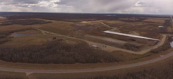
Challenger surveyed numerous landfill disposal facilities across Western Canada using Unmanned Aerial Vehicles (UAV) to support our client’s volume calculations and annual reporting for regulatory requirements.
Survey controls were established at each site for ground truthing and to ensure maximum possible accuracy.
Flyovers were conducted at each location to capture orthophotography and bird’s-eye-view photos for comparison with the original site plan, and to make updates to key plans as needed.
Services Delivered
- Survey Native Files for the Digital Elevation Model (DEM)
- Orthomosaic files for the entire surveyed area of each site
- Bird’s-Eye-View photos from all sides and corners of the property to capture the landfill and infrastructure
- CAD file incorporating updated surface data
- Updated Key Plans
- Google Earth KMZ files for each site