Fort McKay Community Boundary Design
Fort McKay First Nation
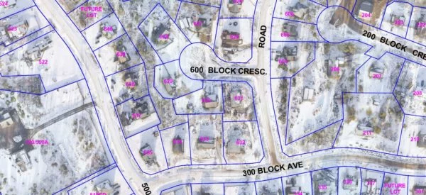
Project Summary
The Community of Fort McKay was mapped using our aerial drone. The imagery was then created and utilized to design 6km of road boundaries and 280 future lot boundaries from existing infrastructure such as buildings, fences and roads. Preserving the existing use of land was also a key component of designing such future property boundaries.
Services Delivered
- Aerial Imagery (mapping of Community)
- Two Presentations for the Local School
- Consultations with Client & FNLM Resource Centre Staff
- Identify Boundary Concerns & Offer Options for Solution
- Creation of ‘Street View’ video from data collected
- CADD Design and Fiche Sheets of the Community Roads and Future Lots