Inuvik-Tuktoyaktuk Highway
E Grubens Transport
Project Summary
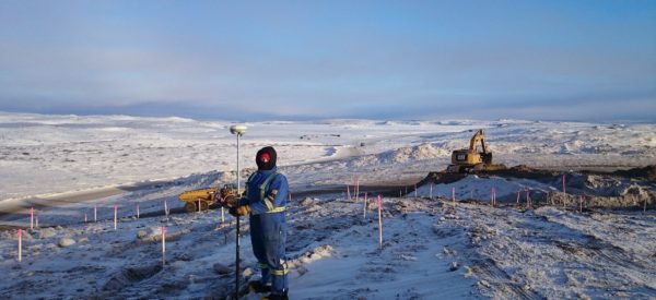
Operating as one of our majority aboriginal-owned partnership companies, Inukshuk Geomatics Inc., Challenger provided survey support for km 52-138 of the Inuvik-Tuktoyaktuk Highway (ITH) project. This road between Inuvik and Tuktoyaktuk on the Arctic Ocean is one of the most technically demanding highway projects to be completed in Canada, with much of the route being constructed over permafrost with little support infrastructure.
Services Delivered
- Set 3D control points along the route using static and RTK GNSS.
- Surveys for all road construction and aggregate sources.
- Topographic survey on remediation areas during various stages of excavation.
- Volume calculations.
- Topographic surveys on each layer of material.
- Final as-built survey for NT Department of Transportation.
- Published plans certifying volumes and surfaces.
- Maintenance of comprehensive drawing base identifying each phase of excavation and grading.
- Preparation and checking of GNSS machine control digital files; QA/QC of GNSS calibration of machine control systems.
- Legal survey of highway; access roads to borrow pits and land exchange parcel for Inuvialuit.

Client: E Grubens Transport
Location: Inuvik, Northwest Territories
Awards
- David Thompson Award for Challenging Cadastral Survey Project in 2018
