First Nation Land Management
Fort McKay First Nation
Project Summary
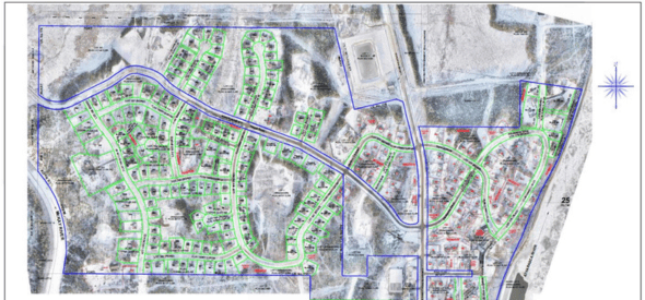
Legal survey for Fort McKay First Nation of existing Internal Community roads to finalize the internal survey fabric within their Reserve lands. One of many stages supporting the Band’s development of a Land Code for their Community under the Framework Agreement on First Nation Land Management (FNLM).
Services Delivered
- UAV survey and custom Street View video to obtain as-built imagery of road infrastructure.
- Desktop assessment to assess, design, and establish the road linework.
- Legal survey to create road boundaries.
- Ongoing subdivisions of the various “Blocks” created by this survey.
- Ongoing surveys for additions to Reserve (transfers from Provincial lands).