The Power of Aerial Photogrammetry Surveys in City and Municipal Planning
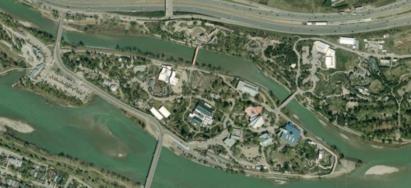
In the dynamic landscape of urban development, cities face numerous challenges in ensuring sustainable growth, efficient infrastructure, and environmental stewardship. To navigate these complexities, forward-thinking municipalities are turning to innovative solutions, one of which is the utilization of photogrammetry surveys. Aerial photogrammetry surveys offer a plethora of benefits that can revolutionize city planning and management. We’ve been working with the City of Calgary since 2005 to provide them with digital aerial surveys.
Airborne photogrammetry surveys entail the systematic acquisition of high-resolution aerial imagery using photogrammetric-grade analog/digital cameras mounted on aircraft or unmanned aerial vehicles (UAVs). Photogrammetry technology, based on the principles of triangulation and image processing, allows for the accurate reconstruction of 3D objects and terrains from 2D aerial images and to accurately measure distances and map features, while also generating georeferenced ortho mosaic products.
With nearly two decades of experience, we have compiled a list of reasons why cities and municipalities would benefit from harnessing the expertise of photogrammetry surveys and how this approach can unlock the full potential of urban spaces.
Efficiency Redefined:
Temporal efficiency is paramount in urban planning endeavors, and airborne photogrammetry surveys offer unparalleled expediency. By systematically covering vast extents of land from an elevated perspective, these surveys swiftly acquire comprehensive data, minimizing disruptions to urban activities and expediting the planning process.
Precision at Scale:
In the realm of city planning, precision is imperative. Airborne photogrammetry surveys, leveraging advanced imaging sensors and processing algorithms, deliver accurate measurements and detailed mapping of terrain features and infrastructure. The resulting high-resolution imagery facilitates precise spatial analysis and informed decision-making in urban development initiatives.
Cost-Effectiveness:
Contrary to misconceptions, investment in airborne photogrammetry surveys yields substantial long-term cost savings for municipalities. While the initial capital outlay may appear significant, the efficiencies gained, including reduced fieldwork expenses and optimized resource allocation, translate into tangible returns over time. This cost-effectiveness underscores the value proposition of adopting photogrammetry surveys as a strategic urban planning tool.
Safety Ensured:
Airborne photogrammetry surveys obviate the need for ground-based surveyors to traverse hazardous terrains or inaccessible areas, mitigating risks and ensuring occupational safety. By prioritizing safety through aerial reconnaissance, municipalities uphold their commitment to safeguarding the well-being of field operatives involved in urban development initiatives.
Insights for Informed Decisions:
In the fast-paced realm of city and municipal planning, decisions must be grounded in data-driven insights to yield desirable outcomes. Photogrammetry surveys serve as a rich source of information, offering multidimensional perspectives on land use, environmental dynamics, and infrastructure networks. This data enables cities to make informed choices that resonate with their long-term vision, whether it’s identifying optimal sites for infrastructure projects or assessing the impact of urban expansion on natural ecosystems.
Photogrammetric Expertise:
Central to the success of airborne photogrammetry surveys in city planning is the expertise of photogrammetric professionals. These professionals possess specialized knowledge and skills in aerial imaging, sensor calibration, and photogrammetric processing techniques. Their proficiency ensures the accuracy and reliability of survey results, instilling confidence in decision-making processes and enhancing the efficacy of urban development endeavors.
In summary, Airborne Photogrammetry surveys represent a transformative tool in the arsenal of city planners, offering a panoramic view of urban landscapes and unlocking opportunities for sustainable growth. By embracing photogrammetry surveys, cities and municipalities can leverage advanced imaging technology to navigate towards a vibrant, resilient future. With efficiency, precision, and safety as guiding principles, photogrammetry surveys pave the way for cities to realize their full potential and thrive in an ever-evolving urban landscape.