Photogrammetry vs. Conventional Land Surveying: Which is Right for Your Business?
In today’s rapidly evolving landscape, advancements in technology are transforming how we approach land surveying. For decades, conventional land surveying has been the standard method for measuring land, establishing property boundaries, and supporting infrastructure projects. However, photogrammetry, a surveying technique using high-resolution imagery stereos to generate detailed 2D and 3D maps, has introduced new possibilities, particularly for large-scale or hard-to-access sites.
Both techniques have their strengths, and understanding their differences will help you determine which approach best suits your project needs.
What is Conventional Land Surveying?
Conventional land surveying relies on ground-based data collection using tools such as total stations, theodolites, and levels. Surveyors gather physical measurements of distances, angles, and elevations, typically with high accuracy, by manually capturing data on-site. These measurements are then used to create maps, models, and plans for property boundaries, construction projects, and infrastructure development.
Key Features of Conventional Land Surveying:
On-Site Data Collection: Surveyors must physically be present on the site to gather data, ensuring nothing is overlooked and site-specific nuances are captured.
High Accuracy: Conventional surveying provides precise, ground-based measurements, making it the preferred method for projects where exactness is critical, such as boundary surveys, infrastructure development and legal land disputes.
Labor-Intensive: Due to its hands-on nature, conventional surveying means every detail is accounted for. With skilled professionals dedicating time and expertise to your site, you can be confident in thorough, meticulously gathered data.
Ground-Level Viewpoints: Data collection measures from the ground, providing a practical, real-world view of the site. This perspective ensures measurements are rooted in the physical reality of the terrain, making it invaluable for projects that demand authenticity and on-the-ground verification.
What is Photogrammetry?
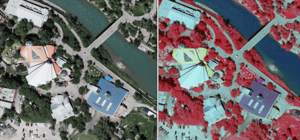
Photogrammetry is a technique that uses aerial imagery, typically captured by drones, aircraft, or satellites, to generate accurate 2D orthomosaics and 3D models of terrain, structures, and other physical features. Through the 3D reconstruction of overlapping images, photogrammetry software on specialized workstations can calculate measurements, extract detailed terrain data, and create real-life visualizations. These images are analyzed in a stereoscopic environment, allowing for the identification and collection of geospatial information. Photogrammetry is widely applied in fields, such as topographic mapping, urban planning, infrastructure development, and environmental monitoring.
Aerial Data Capture: Drones or aircraft capture large volumes of data from the air, providing a comprehensive, top-down view of the entire site. This makes photogrammetry ideal for large-scale or remote projects.
Efficient for Large Areas: Unlike conventional surveying, photogrammetry can cover vast areas in significantly less time, reducing the need for multiple site visits or extended on-site labor.
Detailed 3D Models: One of photogrammetry’s primary advantages is its ability to create detailed 3D models and high-resolution maps, which offer a realistic visualization of the terrain or structure.
Cost-Effective for Large or Remote Sites: Due to reduced manpower, faster data collection, and the ability to safely survey difficult terrain, photogrammetry is often more cost-effective for large or hard-to-reach areas.
Comparing Photogrammetry and Conventional Land Surveying
Key differences between photogrammetry and conventional land surveying across several important factors:
1. Accuracy
Conventional Land Surveying: Offers exceptionally high accuracy, particularly for small to medium-sized sites where precision is paramount. The ground-based data collection allows for pinpoint measurements, making it ideal for legal property boundaries, infrastructure development, and structural layouts.
Photogrammetry: Photogrammetry can achieve high-resolution imagery and rigorous processing through professional-grade software and workstation. It is suitable for most large-scale projects and accuracy is based on the clients requests.
2. Data Collection Speed
Conventional Land Surveying: Data collection is manual, and the time required scales with the size and complexity of the site. Revisits may be necessary to gather additional measurements.
Photogrammetry: Aerial capture allows for rapid data collection, especially over large or difficult terrain.
3. Cost Considerations
Conventional Land Surveying: The process is labor-intensive and typically requires more on-site personnel and time, leading to higher costs, particularly for large or remote areas.
Photogrammetry: For expansive or hard-to-access sites, photogrammetry is more cost-effective due to reduced labor requirements and faster turnaround. However, smaller projects with high accuracy needs may not see a cost benefit from photogrammetry.
4. Safety
Conventional Land Surveying: Although safety is a top priority, surveyors often have to navigate hazardous terrain or work in challenging environments, which can introduce safety risks, particularly in remote or uneven areas.
Photogrammetry: Drones and aircraft eliminate the need for personnel to enter potentially dangerous areas, significantly enhancing safety. This is a major advantage for surveying cliffs, unstable ground, or heavily forested regions.
5. Visual Data and Deliverables
Conventional Land Surveying: Provides highly accurate, but often two-dimensional maps and data points, which are perfect for land delineation but is limited in visual representation.
Photogrammetry: Produces orthophotos and detailed 3D models, offering a richer visual representation that can be particularly useful for clients in construction, urban planning, and land development.
When to Use Conventional Land Surveying
Conventional land surveying remains the best option for projects requiring the highest level of precision and compliance with legal standards, such as:
Boundary surveys: Establishing precise property boundaries for legal purposes often requires the accuracy of conventional methods.
Small, complex sites: When working in smaller areas with intricate features, ground-based surveying may be better suited for detailed measurements.
Regulatory requirements: In some cases, only conventional surveying methods can satisfy local or legal regulations, particularly for property disputes or government-related work.
Small Areas: For limited project footprints, conventional surveys are often the most cost-effective option.
Highest Accuracy: When decisions rely on exact data, conventional surveying ensures results at higher accuracy level than photogrammetry.
When to Use Photogrammetry
Photogrammetry excels in projects where speed, efficiency, and rich visual data are key:
Large-scale projects: For surveying highways, pipelines, or entire urban developments, photogrammetry significantly speeds up data collection and provides valuable 3D visualizations.
Remote or hazardous sites: When sites are difficult to access or pose safety risks, photogrammetry minimizes the need for personnel on the ground, ensuring a safer and more efficient process.
3D modeling requirements: For industries such as construction or urban planning, where 3D visualizations are critical for design and decision-making, photogrammetry is the superior choice.
Natural Boundary Mapping: Effective for capturing terrain and environmental features over broad or irregular areas.
Scouting: Useful for rapid site assessments and project planning.
Since 2005, Challenger has been at the forefront of a variety of photogrammetry surveying and mapping projects that make a real impact. Here’s a taste of some of the exciting work we’ve been a part of:
The decision between photogrammetry and conventional land surveying depends on the specific needs of your project. For projects requiring rapid data collection over large areas or high-resolution 3D models, photogrammetry offers significant advantages. However, for smaller sites or projects where accuracy and legal compliance are critical, conventional land surveying remains the gold standard.
Both methods have their place. By leveraging the strengths of each, you can choose the most effective solution for your surveying needs.
To find out which one is right for your project, contact us.