Calgary Flood Mapping
Project Summary
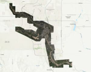
In response to the 2013 Calgary flood, our team provided critical pre- and post-flood mapping on the second day of the disaster, aiding emergency response efforts and supporting flood insurance assessments. Our data helped residents navigate recovery efforts and was utilized by the City of Calgary on their website to share real-time updates and resources. Additionally, our mapping data played a role in a public petition aimed at improving emergency planning and flood response for future events, highlighting the importance of proactive disaster management.
Project Duration: June-July 2013
Project Manager: Sally Wu
Project Priority: Quality, Time then Money
Estimated Project Budget: $55,000.00
Approximate Hours: 100
Service Delivered and Outcomes
Products Provided:
- High resolution (10cm) Air Photography Acquistion over the affected areas in the City of Caglary
- Pre- and post-flood maps
- 3D flood models
- High watermark line collections along Bow River & Elbow River in photogrammetry work stations
- Data sets for emergency response and flood insurance purposes
Services Provided:
- Aerial surveys of flood zones
- Real-time data collection and mapping
- Emergency response support through rapid data delivery
- Data sharing with the City of Calgary for public use
- Contribution to flood-related emergency planning petitions
Data Outcomes:
- Accurate mapping of flood-affected areas for disaster management
- Visual data used by the City of Calgary to inform residents via their website
- Comprehensive support for flood insurance claims and assessments
- Data that informed a petition to improve emergency planning for future floods
Project Priority
- Quality
- Time
- Money
Problem Solved
The pre- and post-flood mapping enabled emergency responders to quickly assess affected areas, helping them prioritize resources and save lives. The data also supported flood insurance assessments, allowing residents to file accurate claims and recover more quickly. Additionally, the City of Calgary used the data to inform the public via their website, improving communication and transparency. The project also contributed to better future emergency planning through a petition that addressed flood preparedness.
Project Communication and Collaboration Summary
Our long-standing relationship with the City of Calgary of providing annual digital aerial surveys for the past 20 years allowed Challenger to respond quickly and effectively. We were able to provide the city with up-to-date pre and post imagery within days of the disaster.
Learn more about the City of Calgary Annual Digital Aerial project here.
Lessons Learned
- Timely Data is Crucial in Emergencies: Providing pre- and post-flood mapping within days of the disaster was essential for effective emergency response and recovery. Speed in data collection and sharing can drastically improve disaster management outcomes.
- Collaborative Efforts Enhance Response: Close collaboration with the City of Calgary and other stakeholders allowed for better coordination and the dissemination of critical information to the public, demonstrating the importance of partnerships in crisis situations.
- Technology Can Aid in Insurance and Recovery: The accurate data provided was invaluable for flood insurance assessments, proving that real-time aerial surveys and mapping are powerful tools in helping individuals recover faster from natural disasters.
- Public Communication is Vital: Sharing real-time updates via the City of Calgary’s website helped keep residents informed, emphasizing the need for clear, accessible communication channels during emergencies.
- Preparedness is Key: The petition sparked by the project highlighted the importance of proactive planning and data-driven decision-making in improving future flood preparedness and emergency planning efforts.
Innovative Approaches and Outcomes
The 2013 Calgary Flood project introduced innovative approaches such as real-time pre- and post-flood mapping through photogrammetry and aerial surveys, enabled quick damage assessment and more efficient emergency response. The data was integrated into the City of Calgary’s public website, improving communication with residents and aiding flood insurance assessments. This approach helped residents recover faster and informed for better future flood emergency planning. The project set a new standard for using geographic data to enhance disaster response, public awareness, and long-term preparedness.