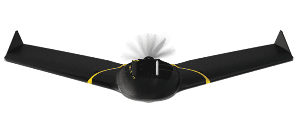
Introducing the New eBee X
Challenger has upped our aerial mapping game with our recent upgrade to the new eBee X fixed wing drone.
This Unmanned Aerial Vehicle (UAV) joins our fleet of rotary and fixed wing UAV technology, and is a significantly upgraded evolution of senseFly’s previous eBee deployed by Challenger. Enhanced capabilities include an endurance extension that allows for additional flight time compared to the previous eBee drone. New camera options are also included to accommodate all kinds of mapping jobs.
Our UAV team is excited about the many applications for the technology available within the new eBee X:
-
- Grid Surveying
- Cadastral Mapping
- Topographic Mapping
- 3D Models
- Contours and Digital Elevation Models
- Site Inspection
- Volume Calculation
- Orthomosaic Maps
Easy takeoff and steep landing capability for this UAV allow it to be deployed on space-restricted sites. Challenger has the capability to deploy this Unmanned Aerial System (UAS) for surveys anywhere in Alberta, the Yukon, Northwest Territories, and Nunavut.