New, Cutting Edge Survey Technology Acquired by Challenger
At Challenger Geomatics, we pride ourselves in being early adopters and have decided to upgrade our GNSS survey equipment. Did you know that Challenger was one of the very first survey companies in Canada to equip our field crews with GPS technology?
After a thorough internal review, we opted for the latest generation of Leica’s Global Navigation Satellite Systems (GNSS) technology. The close integration between Smart Antenna, RTK Rover, Field Controller, and software advances made this a highly attractive proposition for our clients.
Why are we making this change?
Not only is it easier to collect or layout GPS points in the field, but it’s also more efficient to take that field data back to the office and generate measurements in three dimensions. The new GNSS equipment incorporates machine learning principles and automates corrections.
No more leveling the pole at each point, the new tilt-compensating rover gives you those seconds back. Our field crews can complete more – in less time.
Advances in the software enable us to do more in real-time. The controller interface allows us to swipe, drag and rotate the view as needed. We can process three dimensions. This 3D immersion will reduce data formatting time required for our client’s projects.
Challenger is one of the first companies in Western Canada to deploy this new technology in the field. We believe that even in lean economic times, the efficiencies and savings we can realize from the latest in survey technology are an important investment in our ability to support our clients’ success.
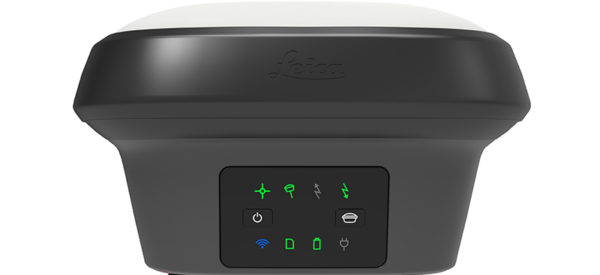
Leica Viva GS16 – Self-Learning GNSS Smart Antenna
Our new Leica Viva GS16 Smart Antenna is compact enough to go where it needs to and powerful enough to adapt to changing conditions to find the optimal signals to deliver an accurate position. It uses an advanced RTK (Real Time Kinematic) system, RTKPlus. With the growing number of signals from an increasing number of satellites, the GS16 has 555 channels for tracking more GNSS signals and has the intelligence to adaptively manage and selects the best signal options, delivering better connectivity to crews while they are working in the field. This means less downtime and better efficiency for our surveyors.
Our new GS16 compensates for obstructions or lack of cellular coverage, which is very important for bridging the gap in the many remote areas where our clients have projects. It can even work completely remote if needed for an area that has no cellular coverage, meaning we can go wherever our clients need us.
Leica GS18 T – World’s Fastest GNSS RTK Rover
With our new Leica GS18 T GNSS RTK Rover, we no longer need to ‘level the pole’. The GS18 T GNSS sensor records the exact position and angle of the pole during measurement and automatically compensates.
Not needing to level the pole means our surveyors can measure each point more quickly. With the potential to increase productivity by up to 20%, our surveyors become more efficient in the field, with significant savings to our clients.
This game-changing improvement also means that staking a point is easier than ever. By following the real-time staking instructions and dynamic assistive graphics on their controllers, our field crews can stakeout points much faster, on the first try, and with greater accuracy.
While our new equipment makes us more efficient, it also positively impacts safety. By not having to look at the bubble while leveling the GPS pole, our surveyors are able to be more attentive to their surroundings on busy construction sites, which helps us to continue improving our strong safety performance record.
Challenger’s new RTK Rover can also measure points in hard to access places, like close to buildings or around construction equipment. It is even able to function in locations subject to magnetic interference, a significant limitation of less-advanced previous generations of GPS instruments.
Leica CS20 Field Controller and Captivate Software Package
Equipped with Leica Captivate, our new Leica CS20 Field Controllers give our surveyors an edge. Compared to the older 2D technology still in use by many surveyors, our field crews have the freedom to view and interpret spatial data in the same three-dimensional context as the real world. As a result, we are able to make adjustments more efficiently on site for our clients.
Also, the durable and robust design of our new CS20 Field Controller was internationally recognized by the Red Dot Awards for product design. Its ergonomic shape and highly secure component casing are built to work well in adverse weather conditions.
A common challenge we face often in Alberta and across the North.
In addition, the accompanying Captivate field software package allows us to manage complex data with a simple touch screen interface including survey-specific applications like:
- Leica Captivate – Measure & Stakeout
- Measure and Stake to Line
- Measure to Plane / Grid
- Area Division
- Stake DTM
- Hidden Point
- Traverse
- Sets of Angles
- QuickVolume
- Set Orientation
- Volume Calculations
- Auto Setup
- ESRI Shapefile Exporter
- Measure and Stake to Road
Find out how we can save you time and money on your next survey project. Request a Quote.